

Mt Mitchell is at the headwaters of the Sara River catchment within the Clarence River drainage, located near the crest of the Great Dividing Range on the New England Tablelands to the west of the extensive Guy Fawkes River gorge system. It falls within the Banbai Aboriginal Nation with numerous highly significant cultural features and landscapes. The Wattleridge Indigenous Protected Area (IPA) is located to the south and southeast of Mt Mitchell.
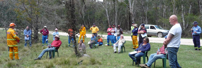
Landholders from the Mt Mitchell area meet to discuss fire management. Mark Graham NCC Ecologist discusses the unique ecological values of the Mt Mitchell area.
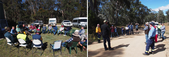
The Hotspots workshop series was held in the Mt Mitchell area because of its extreme bush fire risk, high biodiversity values and cultural significance. There were two workshops held, with Day 1 focussed on fire ecology and property planning and, Day 2 designed to provide hands-on experience observing and participating in a demonstration burn. The workshop series attracted a mix of participants with 28 Mt Mitchell residents attending. Fire management plans were developed for 15 properties, covering an area of 2,455 hectares of which 1,613 hectares were native vegetation. Hotspots is delivered through the coordinated efforts of the NSW Rural Fire Service (RFS) and the Nature Conservation Council of NSW (NCC).
Landowners expressed appreciation for the knowledge they gained specifically on actions they can take to reduce fire risk while improving bushland health. The workshop created a space for landholders to meet their neighbours and a chance to talk with government agency representatives and brigade volunteers.
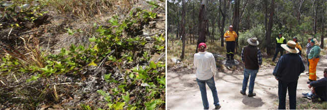
Black Grevillea – Grevillea scortechinii ssp. sarmentosa. RFS Community Safety Officer Scott Keelan shares information about bush fire risk, fire behaviour and the pre-burn notification requirements.
During workshop Day 1 the group visited a selection of long unburnt sites around Aqua Park within Mt Mitchell, as well as a recently burnt part of Warra National Park. These field trips helped workshop participants to better understand the important role that fire plays in the landscape as well as the need to manage fire appropriately across this highly biodiverse area. The field trips also allowed landowners from around the district to learn about the many threatened species known from Mt Mitchell including the endemic Black Grevillea, Grevillea scortechinii ssp. sarmentosa and Warra Broad-leaved Sallee, Eucalyptus camphora ssp. relicta as well as how to manage fire to ensure the survival of threatened fauna species such as the Powerful Owl, Ninox strenua, Glossy Black Cockatoo, Calyptorhynchus lathami and the New England Tree Frog, Litoria subglandulosa.
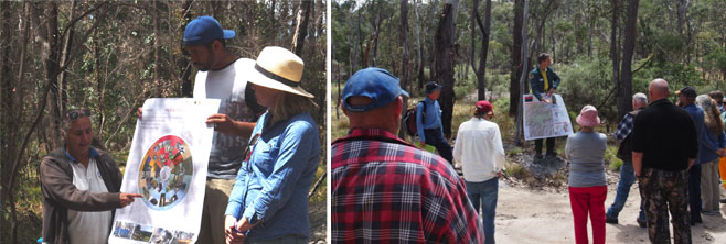
Lesley and Tremane Patterson with PhD research student Michelle McKemey sharing the Fire and Seasons Calendar developed for Wattleridge IPA and surrounding landscapes. NPWS Ranger Koen Dijkstra shares the Warra National Park Fire Management Strategy.
The Aqua Park community is listed as extreme risk under the Northern Tablelands Bush Fire Risk Management Plan. The main sources of ignition for bush fires in the Northern Tablelands area are escaped private burns and occasional lightning strikes. By having land managers working together, people will be better prepared for wildfire events and there should be less chance of escaped burns. Questions addressed on the day included the requirement for a Fire Permit for burning activities during the Bush Fire Danger Period and the need to notify the RFS and adjoining neighbours at least 24 hours before the fire being lit.
The Fire Seasons Calendar draws upon native plant flowering/fruiting times and fauna activity as indicators of when to introduce fire into the landscape. The Wattleridge IPA Fire Seasons Calendar has been prepared using Banbai language for indicator species and fire management tools. The information shared by the Banbai Rangers highlighted the need to ‘know your country’ and ability to ‘read the bush’ before burning. Part of the research being undertaken by Michelle McKemey involved monitoring plant and animal response post fire. The Black Grevillea and the Echidna were chosen by the Banbai Rangers as focus species for the monitoring.
During the field trip, the NSW National Parks and Wildlife Service and Forestry Corporation representatives both shared their fire management strategies and management objectives. Likewise, the Banbai Rangers also shared their fire management plan prepared as part of the Firesticks Project. Addressing fire management at the landscape scale and learning how the public land managers and the Wattleridge IPA prepared their fire management plans enabled landholders to start drafting their own property fire management plans.
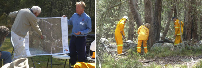
Jim Cousins, Aqua Park landholder and John Allen Hotspots Facilitator share the fire management planning process and the proposed management strategies for Jim’s property. Mt Mitchell brigade volunteers demonstrating the use of rake-hoes (also known as McLeod tools) clearing leaf litter from around a hollow bearing tree prior to lighting the burn.
Day 2 of the workshop series was designed to demonstrate how to plan and conduct a safe prescribed burn on private property. The aim of the workshop is to provide landholders with the opportunity to participate in field-based activities relating to both planning and conducting a safe planned burn. However, with consistent heavy rain the night before the workshop, question was raised among landholders, volunteers and agencies alike as to whether we would proceed with the burn.
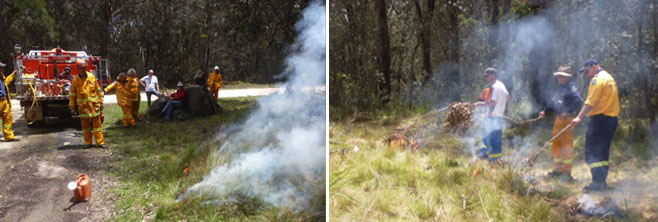
Ken Barker RFS Group Captain, Brian Sleet Mt Mitchell Brigade Captain and volunteers demonstrating fire fighting equipment and lighting patterns. Jason Gee Banbai Ranger, Brian Humphries RFS volunteer and RFS Scott Keelan Community Safety Officer working together demonstrating lighting techniques.
With the determination of the group, a warming of the day and a slight breeze, landholders were able to get some good hands on experiences attempting to light the burn, learn about fire fighting appliances and observe different lighting techniques. This provided the opportunity for the volunteers and Banbai rangers trained in fire fighting to practice hazard reduction burning. Most importantly, the day enabled volunteers and neighbours from all around the Mt Mitchell area to work together on the same burn and hopefully set an example for future joint exercises on private land, NPW Estate, State Forest and Wattleridge IPA.
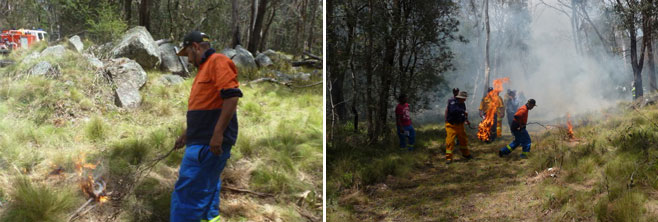
Cody Patterson Banbai Ranger starts to apply fire to the landscape using traditional techniques.
Follow-up opportunities for landholders include attending a cultural event at the Wattleridge IPA, attending a proposed demonstration burn with the Mt Mitchell brigade, and gaining further assistance with pre-incident property planning.
Written by the Hotspots Team through the coordinated efforts of the NSW Rural Fire Service and the Nature Conservation Council of NSW.